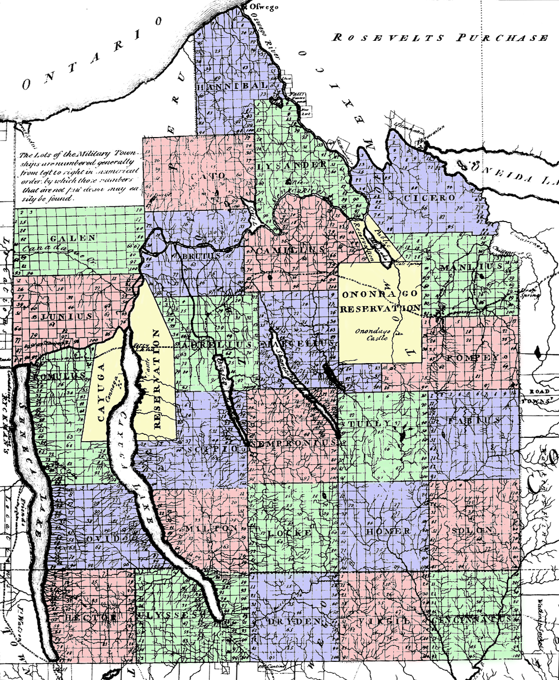
Maps
This space will feature maps that show us the places - from the 1770’s to the present day - that have been most affected by the Sullivan-Clinton Campaign and its Aftermath.
THE SULLIVAN-CLINTON INTERACTIVE MAP
view the Sullivan Clinton Interactive Map
In order for this map to work you must be on a laptop and desktop. This map does not run on mobile.
View the original flash map
Microsoft Edge, Firefox, and Internet explorer run the presentation best. There has been limited success with Google Chrome. Shockwave Flash was officially discontinued by Adobe April 9, 2019. To download an older version of Adobe Shockwave flash please visit adobe.com. Note installing discontinued software carries a risk. If you chose to view this presentation you do at your own risk.
- View the map set online
- View the Flash map set online
- Download the Flash map set for Mac *.sit file
- Download the Flash map set for Windows *.zip file
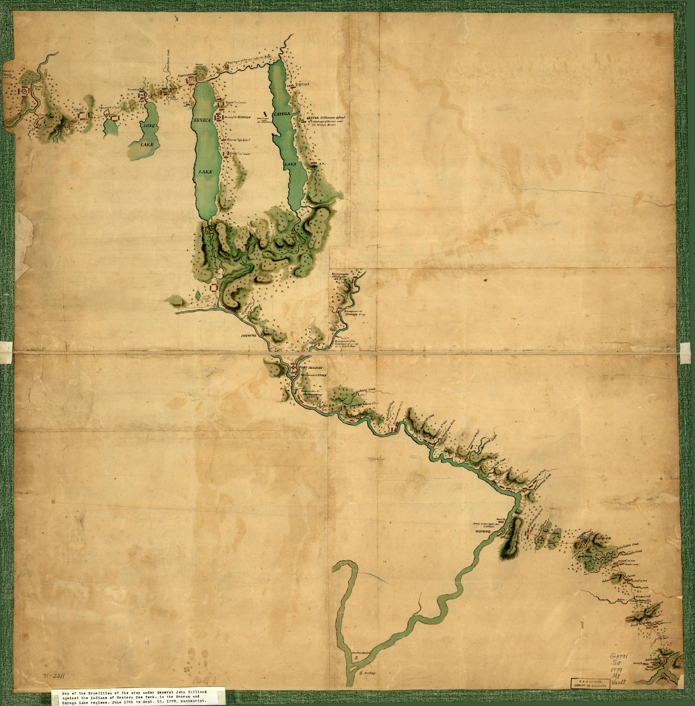
INVASION OF IROQUOIA
Here’s an actual map of the Sullivan-Clinton Campaign from 1779! The mapmaker is anonymous.
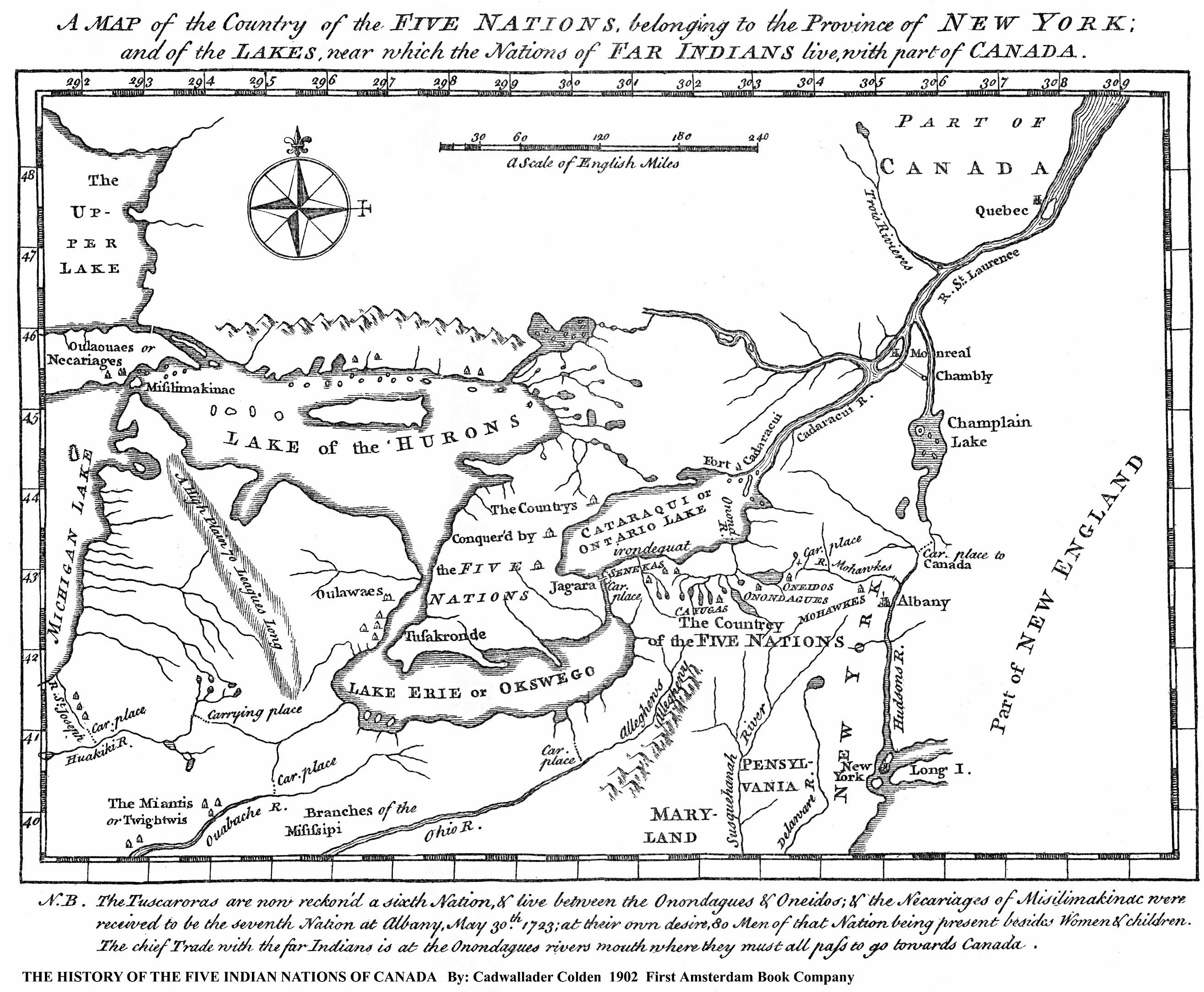
THE HISTORY OF THE FIVE INDIAN NATIONS OF CANADA
By Cadwallader Colden, early 1700’s, - the NY Colony’s first Surveyor-General. Courtesy of Bill Hecht.
NO YORK
By Alan Michelson, 1997
Click icon for a classroom map of NY with only Native American place names.
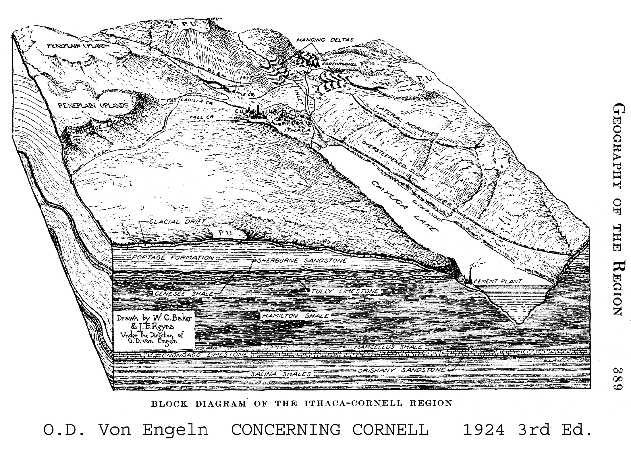
FAR ABOVE (& BELOW) CAYUGA’S WATERS
Where Geology, Development & Dispossession Meet - from a book by Ralph Stockman Tarr - courtesy of Bill Hecht
Click the Icon to launch the map.